A582 and Leyland Road updated proposals
Croston Road improvements - Compulsory Purchase Order and Side Road Order information
All documents relating to the Croston Road CPO and SRO, including plans and supporting information.
Our proposals
The questionnaire is now closed for comments. Thank you to everyone who took the time to complete it.
The proposals are still available to view on our StoryMap page.New proposals have been developed to improve journeys on the A582 between Preston and the M65 and provide better provision for buses, walking and cycling between Preston and Lostock Hall.
The aim is to reduce congestion and improve journey times along the A582 between the M65 and Preston to support economic growth, provide better access to existing employment sites and support the delivery of new homes.
Upgrades on the A582 would also support and enable improvements to be made to the residential routes through Lostock Hall, Lower Penwortham and Preston.
The proposed changes would make these places more attractive and vibrant places to live, and would improve walking, cycling and public transport options.
We’re proposing to use new and advanced technology which will help to manage traffic effectively and prioritise buses and freight through junctions, improving journey times and air quality.
The aim is to reduce congestion and improve journey times along the A582 between the M65 and Preston to support economic growth, provide better access to existing employment sites and support the delivery of new homes.
Why we're doing this
The aim of these proposals is to reduce congestion to support economic growth, provide better access to existing employment sites and support the delivery of new homes already identified within South Ribble's Local Plan.
These plans would support all road users, and seek to reduce transport related carbon emissions and improve air quality by the provision of bus network improvements and enhanced walking and cycling facilities along Leyland Road and Fishergate Hill to enable more sustainable travel choices for local trips.
Map of the A582 major roads network junctions and route
- A582 overview map PDF 5.05 MB
Public engagement feedback
During summer 2024 we carried out public engagement on the A582 Major Road Network Scheme. This included an online survey and a series of drop‑in events.
The responses we received have helped shape the scheme as the designs have progressed. Thank you to everyone who took the time to give feedback.
A summary of the comments received is set out below.
The scheme has been revised in response to this feedback as part of a design review, along with ongoing discussions with key stakeholders.
The information on this page sets out the design updates since the 2024 engagement exercise, reflecting the latest scheme proposals.
- The proposed bus lane on Strand Road has been removed based on the feedback. The updated design now focuses on improving the right‑turn from Strand Road onto Guild Way.
- The pedestrian and cycle crossing at the junction where traffic joins Guild Way will be realigned to make it safer and more convenient for users. The footway under the bridge will also be widened, narrowing the carriageway.
- Traffic signal equipment will be upgraded and localised road resurfacing will be carried out.
- Signage and road markings at the junction will be updated to make the new arrangement safer and more convenient for users.
- The proposed bus-only section, which will be enforced with a bus gate, will include clear signage to help drivers to know and use the correct lane. This arrangement is being implemented to encourage through traffic to use the A582 which has greater capacity at peak times.
- Several respondents asked how they would access Leyland Road with the 'bus gate' in place. Vehicles travelling from Guild Way and Golden Way will not be impacted as right turning onto Leyland Road is permitted. Improvements at the Strand Road / Guild Way junction will compliment this by improving access to Guild Way from Strand Road, avoiding the need to travel through the Broadgate area. Vehicles traveling from the Broadgate and Penwortham areas will be able to go around the Golden Way roundabout to reach Leyland Road via the right turn access, a diversion of approximately 400 meters. Clear, updated direction signage will be provided to guide drivers.
- Further workshops and discussions have taken place with Penwortham in Bloom about the Sail Boat planter, which will move to a more prominent and attractive location with additional landscaping and planting. Benches will be installed, as well as a maintenance lay‑by.
- As a result of consultation with Active Travel England the proposed controlled pedestrian crossing arrangement on Leyland Road to the north of the junction has been upgraded to a parallel crossing for cyclists and pedestrians.
- Both bus stops to the south of the junction on Croston Road will be upgraded to provide accessible boarding points.
- The southbound bus stop to the south of the junction (for buses towards Leyland), will include a wider section of road so buses can pull in without blocking traffic, helping to address congestion and safety concerns.
- A new shared‑use walking and cycling route has been added on the south‑east side of the junction, adjacent to the new attenuation pond, improving access to Centurion Way.
Croston Road improvements - planning application update
The proposed improvements at Croston Road Junction received planning permission on 21 January 2026. You can see details of the application on our website under application reference LCC/2025/0008.
Subject to the approval of a Full Business Case for the overall A582 scheme, specific planning conditions associated with the planning permission will need to be approved before construction is able to start.
Croston Road improvements - Compulsory Purchase Order and Side Road Order information
To make these improvements at the Croston Road junction, a Compulsory Purchase Order (CPO) and a Side Roads Order (SRO) have been made. These orders are required to secure the land and make the highway changes needed for this work.
All documents relating to the Croston Road CPO and SRO, including plans and supporting information.
- Parking near the war memorial has been rearranged to provide sufficient and appropriate parking for Lostock Lane residents, replacing the existing pavement parking arrangement.
- Several comments related to U-turn movements east of the junction, particularly for larger vehicles and access to properties on Lostock Lane and Todd Lane South. The proposed design has been updated to better accommodate U‑turning vehicle movements and maximise safety at the junction:
- The pedestrian crossing on the eastbound exit of the junction has been set back further to ensure good visibility for drivers making a U‑turn and increased stopping distance.
- The right‑turn filter lane has been widened to allow vehicles of all sizes to turn safely, supported by advance direction signage.
- Traffic signal timings will be set to avoid conflict with oncoming traffic, ensuring a dedicated unopposed green light for right turns and U-turning traffic from Lostock Lane.
Scheme proposals include complementary improvements on local access roads adjacent to the A582 to support improved walking, wheeling and cycling connectivity and enhanced road safety. Following the engagement exercise in 2024 the following design updates have been captured in response to comments from the community:
Leyland Road
- Bus stop enhancements are proposed along the Leyland Road corridor, including upgraded boarding points and new shelters where feasible.
- Existing Puffin crossing equipment and tactile paving will be upgraded and, where feasible, installed on a raised table. This revised approach will significantly reduce the number of speed cushions originally proposed.
- A new pedestrian crossing is proposed between Flag Lane and Marina Grove.
Croston Road (School Lane area)
- The kerb layouts have been adjusted to improve safety at the zebra crossing outside St Paul’s Church of England Primary School.
- The proposed pedestrian crossing near the bowling green car park has been moved closer to the school to better align with pedestrian desire lines to and from the school.
- Wider footways at both crossings have been included to provide more waiting space and improved visibility.
Hill Road South
- A zebra crossing is proposed on Hill Road South between Corn Croft and Alderfield in between to the existing bus stops, and the bus stops will be upgraded to include raised boarding points.
- A new raised zebra crossing is proposed outside Middleforth Church of England Primary School to improve safety for school access.
Marshalls Brow
- A new raised zebra crossing is proposed at Middleforth Green.
- A new raised table and zebra crossing has been added at the junction with New Lane and Pope Lane.
Pope Lane
- A number of proposed speed humps along the route will be replaced with raised junction tables, this is to reduce vehicle speeds and to facilitate better crossing opportunities along Pope Lane.
- Additional zebra crossings will be provided, on will be adjacent to the entrance to Rydal Avenue, and one adjacent to the junction of Cop Lane and Pope Lane.
New Lane
- The number of proposed speed humps has been reduced.
Progress on the business case
The Department for Transport approved the scheme’s Outline Business Case in July 2025. Since then development of the schemes detailed design has continued, shaped by feedback from residents and stakeholders.
We are now preparing the Full Business Case, which will be submitted to the Department for Transport once complete. Approval of the Full Business Case will allow the project to move into the delivery phase.
Before construction can begin, essential pre‑construction work will be completed, such as site surveys and traffic management planning. Updates will continue to be shared throughout the construction phase.
Key milestones
- Making of the Compulsory Purchase Order and Side Roads Order – Spring 2026
- The submission of applications to discharge pre-construction conditions relating to the Croston Road planning application - beginning Summer 2026.
- Submission of Full Business Case to Government – Spring 2027
- Construction to begin – Summer 2027
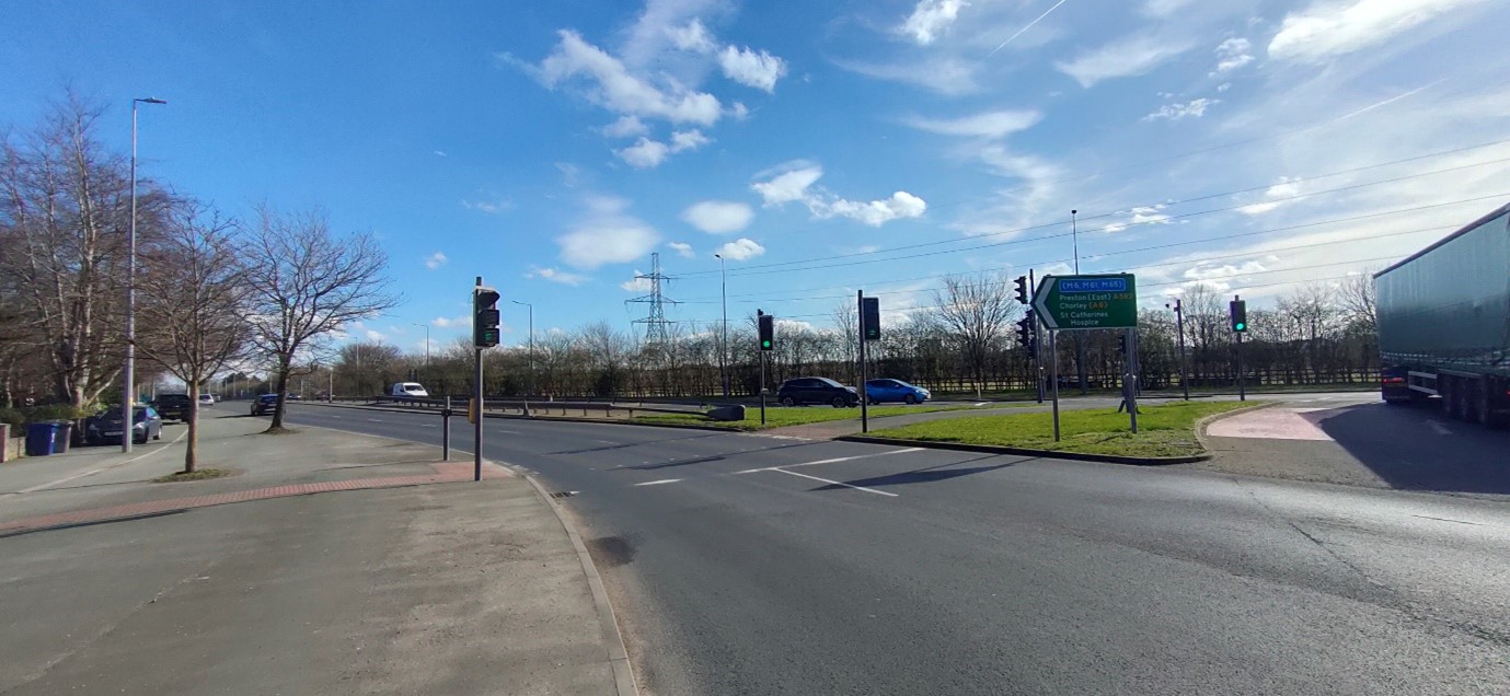
About the route
The A582 is a key route across South Ribble, running between the M65 junction at Cuerden to the 'Tank' Roundabout next to the Household Waste Recycling Centre at Farington, then continuing towards Penwortham and onto Preston.
These revised proposals reflect changes in travel habits, including post-Covid flexible working arrangements, since the original scheme was set out and the publication of the Government's Transport Decarbonisation Plan in 2021.
Creating a dual carriageway
The A582 scheme had previously proposed the creation of a dual carriageway along the A582. The creation of a dual carriageway is still an aspiration.
These latest proposals will help by providing additional capacity along the road, while still working towards the potential for dualling in the future. The new design has been developed to fit with both the existing road and any future dualling proposal.
Find out more information about the new proposals in the Cabinet report.